 Gateway to Mars
SpaceX expansion November 6, 2026 · Cameron County · Land
County deeds show SpaceX bought about 390 more acres east of Brownsville
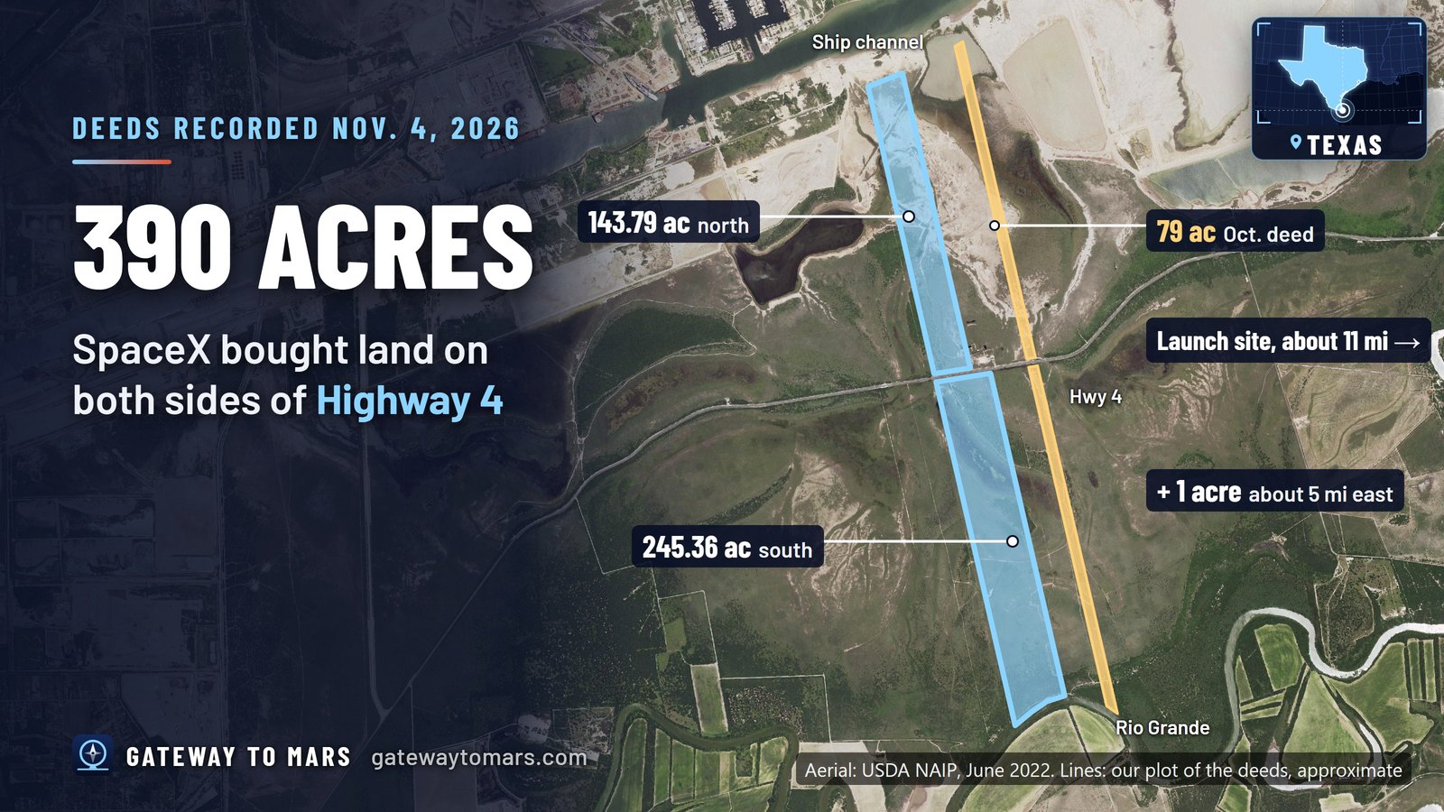
Three deeds recorded with the Cameron County Clerk on Wednesday, Nov. 4, 2026 show SpaceX bought about 390 acres east of Brownsville. Two big tracts face each other across Highway 4 (Boca Chica Boulevard). One runs north to the ship channel, and the other runs south to the Rio Grande.
- South of Highway 4: 245.36 acres, from the highway to the bank of the Rio Grande (document 2026-40565). The tract is about 1,322 feet wide along the highway and about 1.5 miles long.
- North of Highway 4: 143.79 acres, from the highway to the south line of the ship channel (document 2026-40575). It is about 880 feet wide along the highway and about 1.3 miles long.
- The third deed: 1 acre in Palmito Estates, about 5 miles farther east (document 2026-40555).
- Where it is: by our plot of the deeds' survey calls, the two big tracts meet Highway 4 about 11 miles west of the launch site. The north tract sits roughly a quarter mile west of the 79-acre strip SpaceX bought in October, and the south tract about a fifth of a mile, with other parcels in between.
- No price: each deed lists only $10 "and other good and valuable consideration."
- A separate agreement: the deeds for the two big tracts mention a "separate Agreement Regarding Further Purchases and Confidentiality." They don't give its terms.
What it is for: SpaceX hasn't said, and the deeds don't say.
Background: With the 79-acre strip (our Oct. 28, 2026 story), these four deeds come to about 469 acres. County deeds recorded in September show SpaceX bought the surface of about 1,500 acres near the Port. Our Oct. 16, 2026 story.
Next: we'll report any more SpaceX deeds we find.
Sources: Cameron County Clerk, document 2026-40565 (Special Warranty Deed, 245.36 acres) · document 2026-40575 (Special Warranty Deed, 143.79 acres) · document 2026-40555 (Special Warranty Deed, 1.0 acre) · document 2026-38676 (Special Warranty Deed, about 79.01 acres) · Aerial: USDA NAIP via USGS The National Map (public domain); tracts plotted by Gateway to Mars from the deeds' survey calls
Know before the next launch: get free Launch Alerts by email, or follow us on X and Facebook.